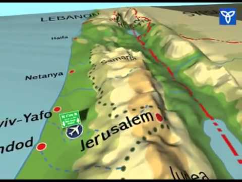
“Unfortunately, it’s very common in political discussions by pundits and commentators today to say “Israel must withdraw to the 1967 borders.” There’s only one problem with that analysis: there are no 1967 borders. The lines Israel inherited from the 1948 war are called armistice lines. They’re very different from international boundaries that exist elsewhere in the world.”

– Amb. Dore Gold, President, Jerusalem Center for Public Affairs, Tuesday, June 27, 2017 (emphasis added)

The point that Lee and I make in our Powerpoint talk (“10 Misleading Expressions” under Videos on our website, www.factsonisrael.com) is that there is a huge international law difference between demanding that Israel retreat to “the 1967 borders” and to the same “1949 Israel-Jordan military ceasefire lines.”

International borders have a gravitas unbroken by subsequent fighting between the same sides.  Mere military ceasefire lines, not least those expressly defined in their defining document, as in the 1949 Israel-Jordan Armistice Agreement, not to be political borders, by their very definition don’t.  They are consigned to history’s dustbin by renewed fighting, again initiated by Jordan, and superseded by new ceasefire lines at the end of renewed fighting between those sides.

As Dore Gold explains in the JCPA posting this week from which the above quotation of him is taken, the U.S. and Britain were the chief drafters of UNSC Resolution 242, after the 1967 Six Day War, which called on Israel to withdraw, under certain conditions, from territories [intentionally not “the territories”] captured in that war, not to the 1949 lines, but to “secure and recognized” boundaries.  (The 1949 lines, 9-miles-wide in the critical lowland middle, had been anything but that.  Eban had called them “Auschwitz lines.”)

In a play on words, President Obama changed the U.S. position [this is the AP’s assessment as well as mine] in a speech at the State Department on May 19, 2011.  He said:

“I believe the borders of Israel and Palestine should be based on the 1967 lines with mutually agreed swaps, so that secure and recognized borders are established for both sides.”

The A.P. assessed:

“President Barack Obama on Thursday endorsed a key Palestinian demand for the borders of its future state.  Obama’s urging that a Palestinian state be based on the 1967 lines was a significant shift in the U.S. approach.”

But the Philadelphia Inquirer, for one, wasn’t satisfied even with that.  It headlined and sub-headlined its front-page article:

“Obama Maps a Peace Path”

“In a major speech, he said a starting point for Israeli-Palestinian talks should be the borders set before the 1967 war.  Netanyahu criticized the idea” [emphasis added]

“1967 borders” is just one of very many Jewish homeland delegitimizing pejoratives not just “in political discussions by pundits and commentators,” as Amb. Gold wrote this week, nor in the mainstream Western media, but even among Jewish and Christian supporters of Israel, in our case, at least, unthinkingly.  It’s “very common,” as Amb. Gold says, so we unthinkingly use it ourselves.  When it comes to Israel reporting word choices, we cannot afford not to think.

This American Independence Day weekend, you may be drawn into around-the-barbeque discussion whether America is “exceptional.”  In our three-millennia institutional memory, America is not “exceptional.”  America is Unique.  God Bless It.

Regards,

Jerry

1 COMMENT

  1. These are the official borders as agreed upon by the Superpowers after WWI:

    Franco-British Convention of December 23, 1920: fixing the northern and northeastern boundary of Palestine with Syria-Lebanon made it clear beyond any doubt that Judea, Samaria and Gaza were to be parts of the Jewish National Home.
    https://www.jstor.org/stable/pdf/2213236.pdf – See Article 1

    FRANCO-BRITISH CONVENTION ON CERTAIN POINTS CONNECTED WITH THE MANDATES FOR SYRIA AND THE LEBANON, PALESTINE AND MESOPOTAMIA1 MANDATES FOR SYRIA AND THE LEBANON, PALESTINE AND MESOPOTAMIA
    1 Signed at Paris, December 23, 1920 Signed at Paris, December 23, 1920

    The British and French Governments, respectively represented by the undersigned Plenipotentiaries, wishing to settle completely the problems raised by the attribution to Great Britain of the mandates for Palestine and Mesopotamia and by the attribution to France of the mandate over Syria and the Lebanon, all three conferred by the Supreme Council at San Remo, have agreed on the following provisions:-

    ARTICLE 1 The boundaries between the territories under the French mandate of Syria and the Lebanon on the one hand and the British mandates of Mesopotamia and Palestine on the other are determined as follows:-
    On the east, the Tigris from Jeziret-ibn-Omar to the boundaries of the former vilayets of Diarbekix and Mosul.

    On the south-east and south, the aforesaid boundary of the former vilayets southwards as far as Roumelan Koeui; thence a line leaving in the territory under the French mandate the entire basin of the western Kabur and passing in a straight line towards the Euphrates, which it crosses at Abu Kemal, thence a straight line to Imtar to the south of Jebul Druse, then a line to the south of Nasib on the Hedjaz Railway, then a line to Semakh on the Lake of Tiberias, traced to the south of the railway, which descends towards the lake and parallel to the railway. Deraa and its environs will remain in the terri- tory under the French mandate; the frontier will in principle leave the valley of the Yarmuk in the territory under the French mandate, but will be drawn as close as possible to the railway in such a manner as to allow the construction in the valley of the Yarmuk of a railway entirely situated in the territory under the British mandate. At Semakh the frontier will be fixed in such a manner as to allow each of the two High Contracting Parties to construct and establish a harbour and railway station giving free access to the Lake of Tiberias.

    On the west, the frontier will pass from Semakh across the Lake of Tiberias to the mouth of the Wadi Massadyie. It will then follow the course of this river upstream, and then the Wadi Jeraba to its source. From that point it will reach the track from El Kuneitra to Banias at the point marked Skek, thence it will follow the said track, which will remain in the territory under the French mandate as far as Banias. Thence the frontier will be drawn west- wards as far as Metullah, which will remain in Palestinian territory. This portion of the frontier will be traced in detail in such a manner as to ensure for the territory under the French mandate easy communication entirely 1 British Parliamentary Command Papers, Misc. No. 4 (1921).

    OFFICIAL DOCUMENTS 123 within such territory with the regions of Tyre of road communication to the west and to the From Metullah the frontier will reach the watershed Jordan and the basin of the Litani. Thence it will follow this watershed southwards. Thereafter it will follow in principle the watershed between the Wadis Farah-Houroun and Kerkera, which will remain in the territory under the British mandate, and the Wadis El Doubleh, El Aioun and Es Zerka, which will remain in the territory under the French mandate. The frontier will reach the Mediterranean Sea at the port of Ras-el-Nakura, which will remain in the territory under the French mandate.

LEAVE A REPLY

Please enter your comment!
Please enter your name here

Previous articleIsraeli general: Cyber terror – why are global leaders waiting for their cyber 9/11?
Next articleHow an earthquake in 1546 made the “Kotel” possible