


Map of Palestine
Click on map to a get a more detailed image
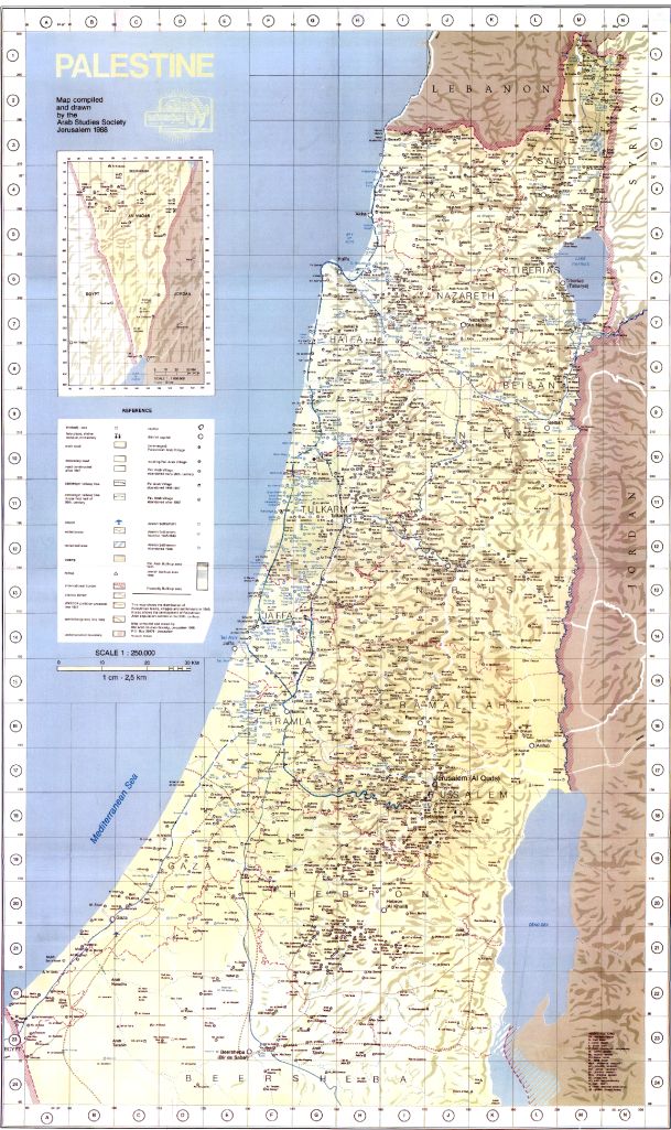
This is the map of Palestine which the PLO “Orient House” was providing for journalists at the Orient House, before it was closed down in August, 2001. Note the fact that everywhere where Jews live is referred to as a “settlement”.
Map of the Palestinian Ministry of Tourism and Antiquities
Click on map to a get a more detailed image
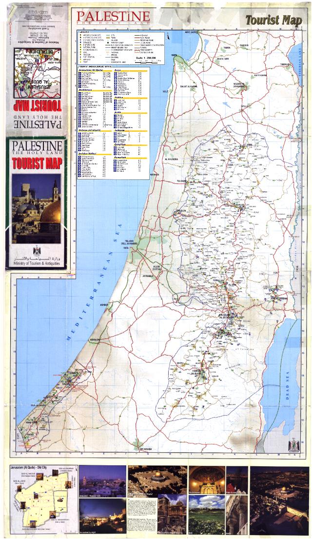
This map was printed with a special grant provided by the United Nations through their “undp” office in jerusalem, as stated. Note the fact that Israel does not exist on this map. A UN Agency has obliterated a UN member.
Palestinian Historical Map
Click on map to a get a more detailed image
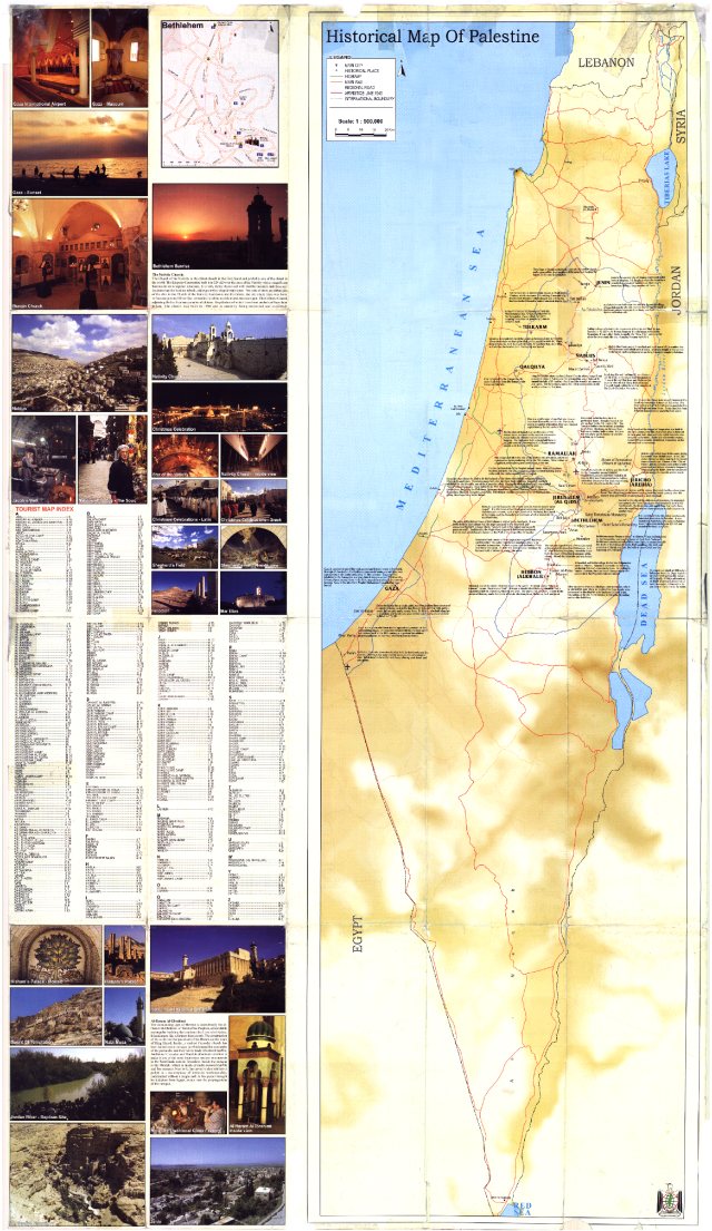
This map, also produced and distributed by the Palestinian Ministry of Tourism and Antiquities, re-writes history and presents the tourist with the idea that only the Palestinian Arabs have roots in the Holy Land.
Israel Vulnerability
Click on map to a get a more detailed image
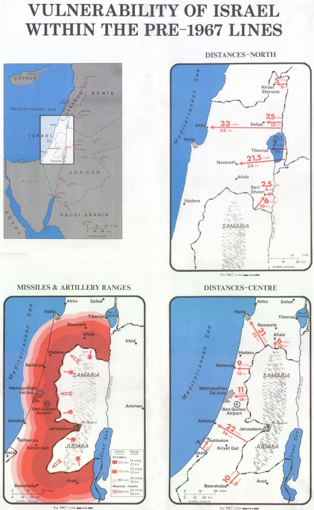
This map, made up back in the nineteen eighties, clearly shows the vulnerability of israel from within its 1949-1967 armistice lines, if the areas of Judea, Samaria, Gaza and the Golan were to be ceded to a lightly armed arab entity.
Destroyed Villages From 1948
Click on map to a get a more detailed image
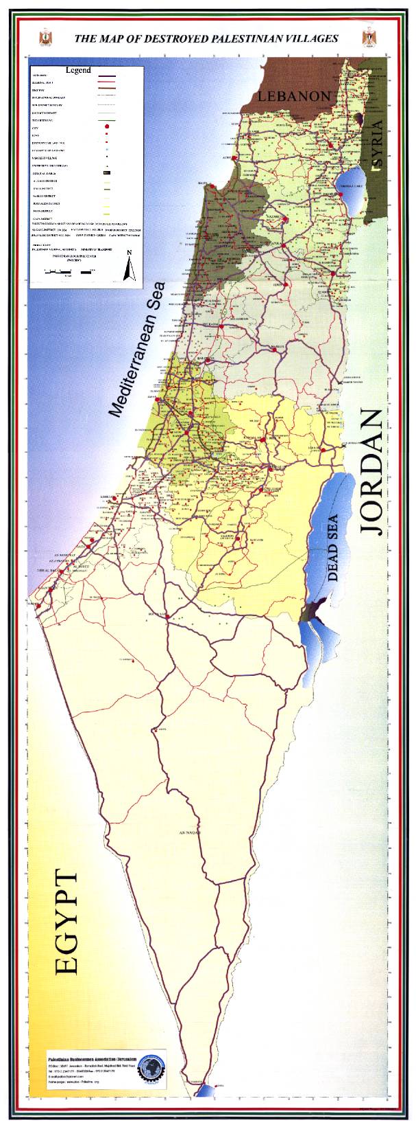
This map, printed by the Palestinian Authority for the Palestinian businessmen association, delineates the areas which show the Palestinian Arab people the villages which they lost in 1948. In any discussion concerning the “right of return”, this map is essential.


